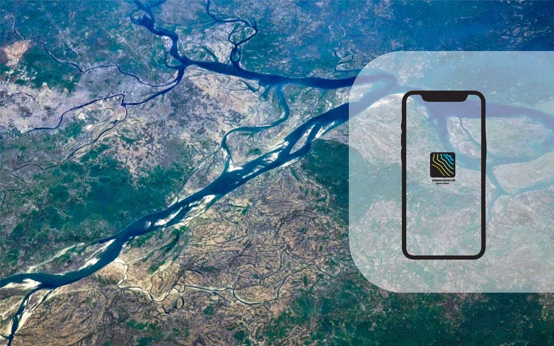
The Bangladesh Erosion Monitor (BEM) is an innovative tool developed through the Google Earth Engine platform, designed to assess erosion and accretion in Bangladesh’s major river systems. This initiative is a collaboration between Deltares from the Netherlands and the Institute of Water Modelling (IWM) from Bangladesh, addressing the need for sophisticated risk assessment in the dynamic Ganges-Brahmaputra-Meghna delta. The BEM tool blends technological innovation with localized expertise, marking a significant stride in addressing environmental challenges in the delta region.
Methodology and Workflow
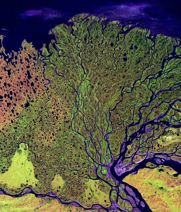
BEM uses the Landsat-derived Global Surface Water Dataset (GSWD), offering a comprehensive planform change analysis from 1984 to 2021. The tool integrates various datasets, including national and administrative boundaries, coastal embankments, and land elevation data. It provides a multi-decadal time series of erosion and sedimentation, enabling users to conduct real-time, comprehensive analyses of erosion patterns.
About Our Work
Key Functionalities and Results
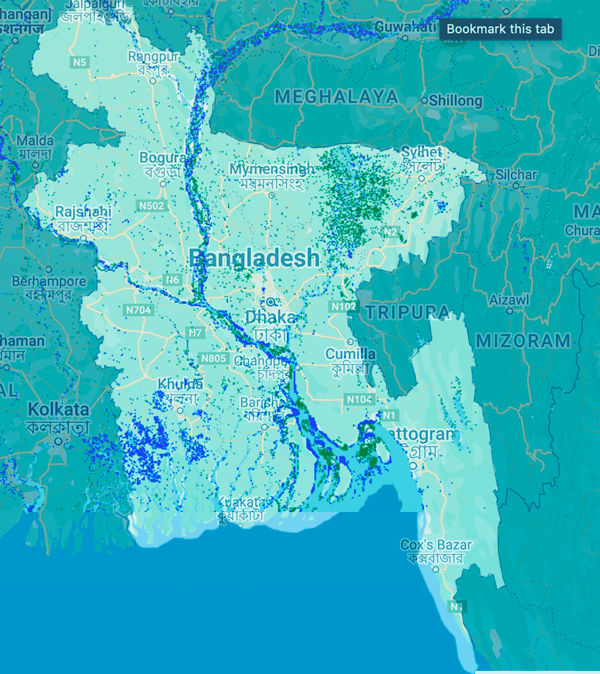
Historical Erosion Monitoring: BEM analyzes Landsat imagery from 1988 to 2021, allowing users to generate historical erosion and deposition trend maps.
Economic Impact Assessment: The tool assesses the economic impact of historical erosion within selected administrative boundaries, combining ESA WorldCover data with local land value estimates.
Erosion Prediction: BEM predicts near-future erosion susceptibility based on historical river bankline data, providing an estimate for every 200m stretch of riverbank.
Flood Inundation Mapping: In the event of embankment breaches, BEM generates flood inundation maps and assesses flood risk, combining model output water levels with elevation data.
Validation and Effectiveness
BEM’s algorithms have been validated against real-time riverbank survey data, ensuring accuracy in detecting historical erosion events and predicting future erosion. The tool has been effective in identifying areas susceptible to erosion and in assisting policy development for managing river erosion and flood hazards in Bangladesh.
Expectations from us
Future Developments
The BEM combines Landsat satellite data and local information to detect and map erosion and sedimentation areas. It assesses erosion trends near polders, embankments, and riverbanks, estimating future erosion probability. For high-risk areas, it simulates potential embankment failure consequences, displaying flood extent and depth in a user-friendly web app for easy viewing and interaction.
While BEM is effective for major rivers, its 30m resolution limits its efficacy for smaller rivers. Future enhancements include improving the algorithm with recent LANDSAT images and considering higher resolution data from Copernicus Sentinel-1 and -2. The inclusion of additional factors like soil properties and flow rates is also planned to enhance the erosion prediction module.
Field Validation and Socio-Economic Impact
Field visits to the Jamuna and Arial Khan Rivers were crucial for collecting validation data and understanding the social impacts of erosion. The next phase involves socio-economic ground truthing, aligning technical findings with tangible socio-economic impacts.
Conclusion and Implications
The BEM tool represents a significant advancement in erosion monitoring. It provides valuable insights for decision-making, with potential applications ranging from infrastructure planning to emergency response strategies. As the project progresses, it is expected to contribute significantly to environmental science, risk management, and policy formulation.
0
Associated Rivers
Lorem ipsum dolor sit amet, consectetur adipiscing elit, sed do eiusmod tempor incididunt.
0
River Erosion
Lorem ipsum dolor sit amet, consectetur adipiscing elit, sed do eiusmod tempor incididunt.
0
Research Studies
Lorem ipsum dolor sit amet, consectetur adipiscing elit, sed do eiusmod tempor incididunt.
0+
Professional staff
Lorem ipsum dolor sit amet, consectetur adipiscing elit, sed do eiusmod tempor incididunt.
Take a look at
Our Partners
lorem ipsum dolor sit amet, consectetur adispiscing elit, sed do eisumod tempor incididunt
Contact Us
Deltares in Netherlands
Check current travel information for diversions or alternative routes on the day of your visit.